This dialog appears when you select a field/geographic map and then click Format > Conditional Formatting on the menu bar, or click the Conditional Formatting button  on the toolbar, or right-click the field/geographic map and select Conditional Formatting from the shortcut menu. It helps you to add some conditional formats to values of the selected field or markers of specific group levels in a geographic map. The options in the dialog varies according to different source it is opened from.
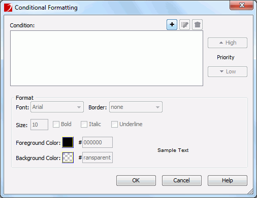
When you select a field to open the dialog, the options in the dialog are as follows. See the dialog.
Condition
Displays all the conditions you have already added.


Format
Specifies the format which will be applied to the field values when the specified condition is fulfilled.
To specify the color, click the color image button and select a color swatch or type the hexadecimal value of the desired color (for example, 0xff0000) in the text box directly. If the color swatches cannot meet your requirement, you can click More Colors to open the Pick a Color dialog, with which you can set a full range of color.
OK
Applies the changes and closes the dialog.
Cancel
Cancels the changes and exits the dialog.
Help
Displays the help document about this feature.
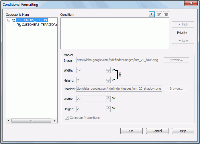
When you select a geographic map to open the dialog, the options in the dialog are as follows. See the dialog:
Geographic Map
Lists all the group levels in the geographic map.
Condition
Displays all the conditions you have already added.
Marker
Specifies the properties of the marker. Available only when there is at least one condition in the Condition box.
Constrain Proportions
Specifies whether to change the width and height for the marker image/shadow at the same time in a certain proportion. If checked, when the width/height is changed, the height/width will also be changed in a certain proportion.
OK
Applies the changes and closes the dialog.
Cancel
Cancels the changes and exits the dialog.
Help
Displays the help document about this feature.